
Official websites use .gov
A .gov website belongs to an official government
organization in the United States.
Secure .gov websites use HTTPS
A lock (
) or https:// means you’ve safely connected to
the .gov website. Share sensitive information only on official,
secure websites.
Public Safety
Public Safety
Natural disasters can wreak havoc on our communities, sometimes in an instant. It is crucial that we understand and predict hazardous weather in order to protect human health and public safety.
The Global Systems Laboratory works on research solutions that model and predict the environment around us. These research products are used in operations that guide government officials and citizens alike.GSL’s data delivery and decision support systems are the cornerstone platform for operations in all 122 NOAA National Weather Service forecast offices. These systems are used to streamline the hazardous weather warning process. Our work investigates:

How can we accurately and quickly predict hazardous weather?

What are the best ways to communicate hazards and impacts to the public?

What can we do to help decision-makers?
High-Resolution Rapid Refresh (HRRR) in operations- GSL also developed the HRRR weather model, a NOAA real-time 3km resolution, hourly updated, cloud-resolving, convection-allowing atmospheric model, initialized by 3km grids with 3km radar data assimilation. Radar data is assimilated in the HRRR every 15 minutes over a 1-hour period adding further detail to that provided by the hourly data assimilation from the 13km radar-enhanced Rapid Refresh. HRRR was implemented into NCEP operations in December 2020. HRRR can predict ceiling heights, visibility, and icing conditions, all critical elements for aircraft operations. View the HRRR model output here.
RRFS is being developed by NOAA GSL and NOAA’s Environmental Modeling Center and is NOAA’s next-generation high-resolution ensemble prediction system underpinned by the community-based Unified Forecast System. RRFS provides hourly forecasts on a 3km grid with 65 vertical layers and is expected to be implemented into NOAA National Weather Service operations in late 2023. View the experimental RRFS model output here.
 Decision-Making and Data Delivery
GSL develops state-of-the-art environmental forecast, decision support, visualization, and evaluation capabilities to provide scientifically robust forecast assessment tools, concepts, and analyses to support decision-making processes affected by the weather. The work directly benefits National Weather Service (NWS) forecasters, Federal Aviation Administration (FAA) air traffic controllers and managers, airline dispatchers and general aviation pilots. GSL also collaborates with the Departments of Defense, Energy, and Interior (Bureau of Land Management).
Hazard and Impact-Based Services
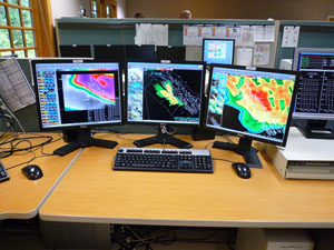
A combination of observational datasets and numerical models are used in the warning process to identify and monitor all hazards. GSL is at the forefront in developing new systems for NWS forecasters and other federal and international agencies who require the display of and interaction with real-time weather data for their forecast and warning operations as well as to support Impact-Based Decision Support Services.
DESI is a prototype application to slice, dice, and visualize meteorological ensemble data. DESI was created by GSL for the NWS to calculate customized scenarios, statistics, thresholds, and timing information because each forecaster and partner has unique needs.
Hazard services is a multi-year, multi-phase effort involving many project partners to produce a powerful software package that modernizes how hazardous weather products are generated by the NWS. This new forecast and hazard creation software is on the Advanced Weather Interactive Processing System (AWIPS) workstation.
FxCAVE - Forecast eXperimental-Common AWIPS Visualization Environment
The FxCAVE system provides access to the display capability of an AWIPS workstation via the web. The system delivers NWS high-resolution gridded numerical weather prediction model data, surface observations, satellite imagery, and radar data from a central server to all the Geographic Area Coordination Centers (GACC) at the National Interagency Fire Center (NIFC).
Weather Archive and Visualization Environment (WAVE)
NWS collaborates with GSL to develop WAVE– a modern, lightweight, scalable application with capabilities to meet the growing demand to communicate probabilistic information in a timely and understandable format. This web-based graphical interface was originally conceived by NWS forecasters.
Threats in Motion
Threats in Motion is the next step in the evolution of how weather information is provided to the public. TiM warning grids update every minute and move continuously with the path of the storm.
Advanced Quantitative Precipitation Information (AQPI)
AQPI is a collaboration with the California Department of Water Resources. GSL's role is to integrate monitoring, assimilation and analysis, and prediction components together into a coherent operating system providing intelligent feedback among the components, as well as delivering quality control, real-time data transfer, and archiving functions.
Next Steps
- National Blend of Models viewer probabilistic graphics - The National Blend of Models (NBM) is a nationally consistent and skillful suite of calibrated forecast guidance based on a blend of both NWS and non-NWS numerical weather prediction model data and post-processed model guidance. The goal of the NBM is to create a highly accurate, skillful and consistent starting point for the gridded forecast. This new way to produce NDFD grids will be helpful providing forecasters with a suite of information to use for their forecasts. The NBM is considered an important part of the efforts to evolve NWS capabilities to achieve a Weather-Ready Nation.
- Impact-based Decision Support System (IDSS) Engine - IDSS are forecast advice and interpretative services the NWS provides to help core partners, such as emergency personnel and public safety officials, make decisions when weather, water and climate impacts the lives and livelihoods of the American people. This support may be needed in response to a particular event or routinely to support high-value decision making.
- FAA
- NWS
- Bureau of Land Management (BLM)


