
Official websites use .gov
A .gov website belongs to an official government
organization in the United States.
Secure .gov websites use HTTPS
A lock (
) or https:// means you’ve safely connected to
the .gov website. Share sensitive information only on official,
secure websites.
Story Maps
Explore GSL story maps to learn more about GSL research and impacts!
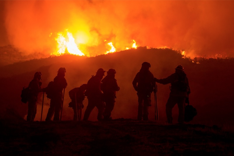
Building a Fire-Ready Nation: A Story Map by GSL and the NOAA Weather Program Office
NOAA is investing toward improved forecast models, advanced decision support capabilities, and construction of new mobile laboratories to deploy to active fires.
By helping build and deploy new observing systems, advance high-resolution forecast models, and accelerate the transition of experimental products to operations, BIL’s investment in NOAA’s fire weather research will help ensure that NOAA continues to build a Fire-Ready Nation.
Read the full story map about how NOAA is Building a Fire-Ready Nation
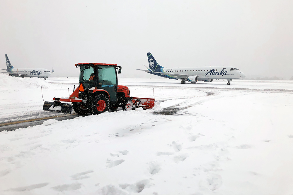
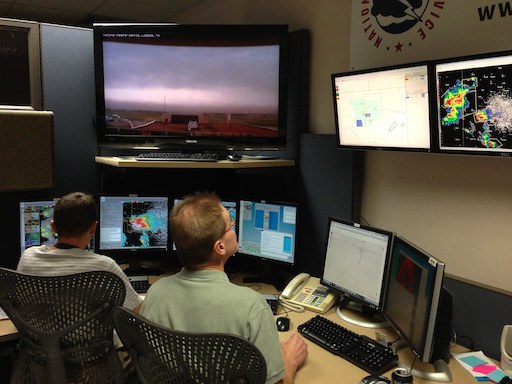
Forecast Verification for Denver International Airport - by Caroline Schwab, GSL NOAA Hollings Scholar
A new study led by GSL Scientists investigates the skill of various forecasting tools in predicting severe winter weather
Aviation managers are often faced with many forecasting options to help make decisions. In winter, these forecasts are used to decide which snow alert level to declare and when to declare it. Snow alerts have significant impacts for airport operations, and for the customers who rely on them.
Read the full story map about "Forecast Verification for Denver International Airport"
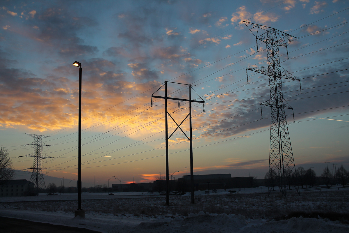
Impacts of NOAA GSL research: Power Lines - by Caroline Schwab, GSL NOAA Hollings Scholar
How GSL's HRRR weather model helps refine Dynamic Line Ratings for power lines, optimizing energy capacity and distribution
Power grids are lifelines that deliver energy to our homes, businesses, schools and beyond. The amount of power that can flow through (known as a line rating ) is meticulously planned and must fit a threshold in order to avoid risk of damage and fires. The line rating has major implications for energy efficiency. GSL’s HRRR weather models are becoming an important piece in planning Dynamic Line Ratings, maximizing energy distribution along power lines.
Read the full story map about the Impacts of NOAA GSL research: Power Lines
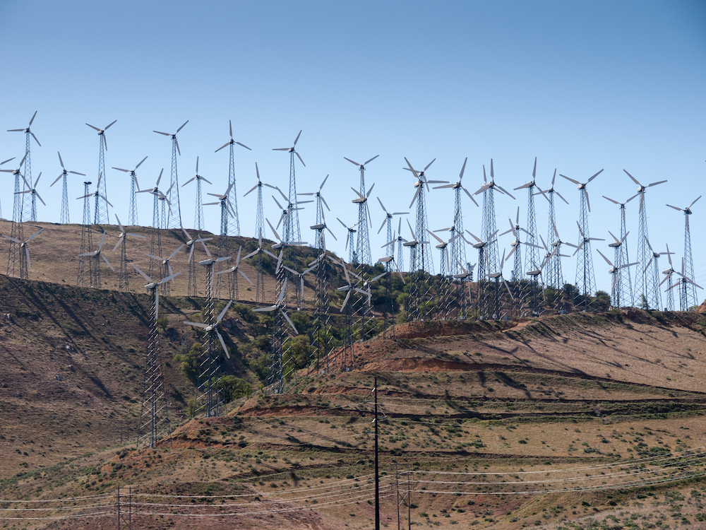
Impacts of NOAA GSL research: Wind forecasts and energy savings - by Caroline Schwab, GSL NOAA Hollings Scholar
How NOAA's Rapid Refresh wind forecasts result in $150 million in energy savings each year and pave the way for other renewables
There are over 70,000 wind farms in the United States. These farms, scattered from the east to west coast, contribute substantially to the country's efforts to use clean and renewable energy. The average single wind turbine generates 843,000 kWh each month , which is enough energy for more than 940 homes. There are on average 150 turbines per farm, meaning one farm can power over 140,000 homes.
Impacts of NOAA GSL research: Wind forecasts and energy savings
NOAA GSL Research to Operations - by Caroline Schwab, GSL NOAA Hollings Scholar
How GSL's research develops tools that support the weather decision-making process
GSL's history was forged in developing tools to support the weather decision-making process. Development began in the 1980's with the Advanced Weather Interactive Processing System (AWIPS) for NWS. These tools are still being developed with incremental deployments of GSL's Hazards Services. GSL's research is also the foundation of NOAA numerical weather prediction (NWP). GSL has become a world leader in the development of storm-scale to global-scale weather prediction models.
Read the full story map about NOAA GSL's Research to Operations work
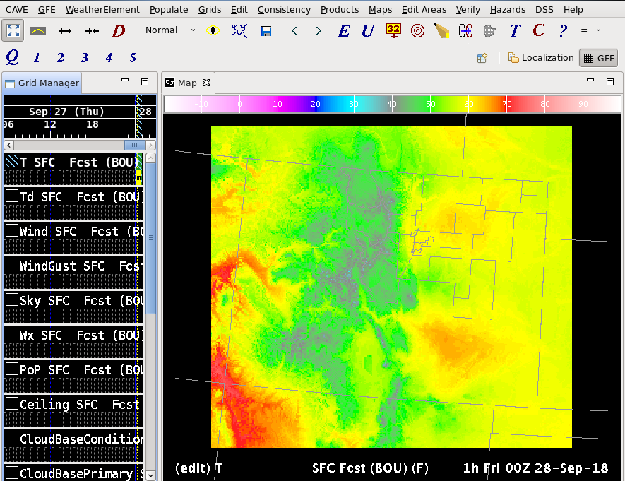
International Expansion of NOAA GSL's Graphical Forecast Editor - by Caroline Schwab, GSL NOAA Hollings Scholar
How GSL research solutions are extending across the world
Since 2021, scientists in the Global Systems Laboratory have been collaborating with nations across the globe to extend and implement the Advanced Weather Interactive Processing System (AWIPS2) and its associated tools, Hazard Services (HS) and the Global Forecast Editor (GFE). This collaboration helps to bolster forecasting operations abroad, in countries such as Australia, Taiwan, and the Philippines.
Read the full story map about NOAA GSL's Graphical Forecast Editor
Smokehouse Creek, GSL and the Bipartisan Infrastructure Law - StoryMap written by Hollings Intern Rae Machado, with guidance from mentors Susan Cobb and Eric Hackathorn.
In recent years, wildfire seasons in the United States have had devastating effects across the United States. Between 2020 and 2023, the National Interagency Fire Center (NIFC) reported 243,503 wildfires that burned over a cumulative 27.5 million acres. Additionally, The Fifth National Climate Assessment found that drier and warmer weather due to climate change could continue the ongoing trend of longer and more severe wildfire seasons.
Read More About The Smokehouse Creek, GSL and the Bipartisan Infrastructure Law