
Official websites use .gov
A .gov website belongs to an official government
organization in the United States.
Secure .gov websites use HTTPS
A lock (
) or https:// means you’ve safely connected to
the .gov website. Share sensitive information only on official,
secure websites.
The future of decision support: DESI 3.0
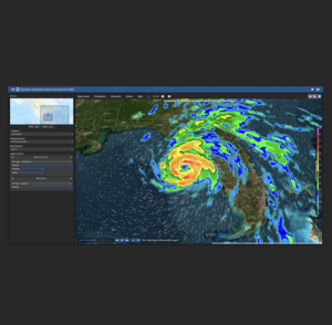
NOAA GSL has released an upgrade to a powerful decision support system to provide forecasters, decision-makers, and other stakeholders with ensemble-based weather forecast information and visualizations. The Dynamic Ensemble-based Scenarios for Impact-based Decision Support (DESI) version 3.0 is a web and cloud-based application that is used by the NOAA National Weather Service to interrogate weather data. NWS meteorologists can use DESI to make graphics for their partners and the public that communicate when and where impacts are expected to occur, and the confidence in those estimates.
A new feature, developed by a GSL-CIRES summer intern, uses the CDC Social Vulnerability Index to support decisions based on human population characteristics such as households without vehicles or internet, mobile homes, English fluency and population density. The CDC Social Vulnerability Index is provided as a map at the census tract level, allowing for visualization alongside ensemble weather forecast variables. This new functionality enables decision-makers to better understand the forecast's impact on public health, facilitating more informed decisions which best protect public well-being.
The DESI architecture has also been redesigned to use kubernetes, a container management platform, so that servers can dynamically spin up to handle larger loads when necessary. These larger loads can be anything from increased traffic or model processing. When the weather is quiet and there are fewer users on DESI, the servers will scale back down to save coasts.
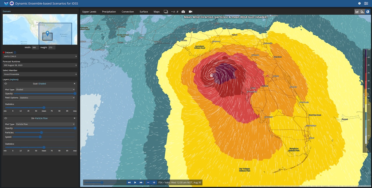
The DESI 3.0 release also includes a variety of other functionality including but not limited to: a sounding viewer, video generator, particle flow to visualize wind direction, joint probabilities and neighborhood probabilities. DESI 3.0 also includes National Blend of Models outside the continental U.S. data, a variety of new maps, and new fields. Coming this spring, GSL researchers are planning improved Decision Support graphics, adaptive domains, and 3D terrain.
This important milestone has contributions from both NOAA/GSL, GSL interns, and the NOAA NWS.