
Official websites use .gov
A .gov website belongs to an official government
organization in the United States.
Secure .gov websites use HTTPS
A lock (
) or https:// means you’ve safely connected to
the .gov website. Share sensitive information only on official,
secure websites.
New NOAA app brings earth and space animations to your phone
Free tool helps teachers, students understand the Earth
An enormous earthquake, the most powerful ever recorded, rocked southern Chile on May 22, 1960 and created a tsunami that raced across the Pacfic Ocean. As giant waves rippled outward, they sped along the shore and bounced back and forth off islands, battering Chile with waves up to 82 feet tall. The astonishing patterns of waves reflecting and refracting across the vast basin are almost too complex to visualize. But now a new free app can bring the power of this massive earthquake to life on your smartphone.
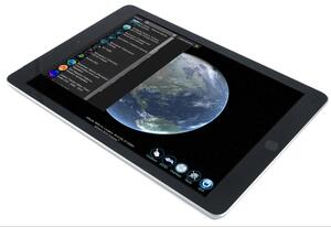
NOAA's SOS Explorer™ Mobile, an app for personal mobile devices, tells earth science stories by playing visually stunning movies on a virtual globe. These aren't your typical movies, however. They’re animations of data — observations of the ocean, atmosphere, space, and land collected by satellites, and the output of numerical models used by scientists to predict and monitor Earth and space.
Access NOAA data anywhere
On the SOS Explorer Mobile app, users can interact with streaming data visualizations— zooming in and out, rotating, scrolling through time, taking guided tours through datasets, and watching embedded educational videos.
SOSx Mobile is the latest addition to a family of data-viewing tools created by NOAA, CIRES, and CIRA scientists in NOAA’s Global Systems Division in Boulder, Colorado. The bedrock of these visualization tools is Science On a Sphere® (SOS), a room-sized animated globe featured in more than 160 museums and visitor centers worldwide. SOS Explorer Mobile and SOS Explorer, a portable flat-screen exhibit-quality version, are designed to help educators, science communicators, students, and the public tap into SOS datasets from their personal devices.
“I use my phone to show sea surface currents, clouds, Saturn’s rings, and much more to anyone who will let me,” said Kate Semmens, science director at Nurture Nature Center, an Easton, Pennsylvania science museum that’s home to one of the 165 Science On a Sphere installations. “It’s a great way to work with teachers and students.”
SOSx Mobile offers more than 115 datasets from NOAA, NASA, and academic institutions, including: Climate models predicting Earth’s temperature through 2100 for different greenhouse gas emissions scenarios; National Marine Sanctuaries’ 360-degree underwater photographs in the Florida Keys; and the entire 2017 hurricane season, including Hurricanes Irma and Maria, as captured by NOAA weather satellites. The SOS website has a range of classroom-ready phenomenon-based lessons that present a compelling image or video clip to hook students into learning more with the datasets in the app.
SOSx Mobile is available now for free at the Google Play Store or Apple App Store. For more information about Science On a Sphere and SOS Explorer, visit sos.noaa.gov.
For more information contact: Susan Cobb 303-497-5093