
Official websites use .gov
A .gov website belongs to an official government
organization in the United States.
Secure .gov websites use HTTPS
A lock (
) or https:// means you’ve safely connected to
the .gov website. Share sensitive information only on official,
secure websites.
GSL receives 2021 National Weather Association aviation award for HRRR
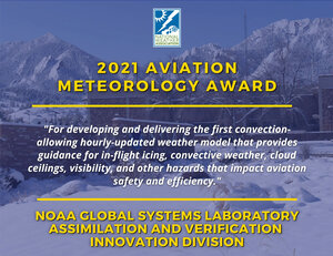

Each day, NOAA’s Weather Forecast Offices provide almost 600 airports with close to 2,500 aviation weather forecasts and about 1,300 inflight forecasts. GSL’s Assimilation and Verification Innovation Division is honored by the National Weather Association (NWA) for developing and delivering the first convection-allowing hourly-updated weather model that provides guidance for in-flight icing, convective weather, cloud ceilings, visibility, and other hazards that impact aviation safety and efficiency. The High-Resolution Rapid Refresh (HRRR) is heavily used in air traffic management decision support tools by the FAA, NWS, and the aviation industry.
The FAA requires frequently updating guidance for hazardous weather decision-making in the 8-hour range. The HRRR weather model, developed by GSL, met that need. HRRR is the result of an experiment partially funded by the FAA to improve forecasts for tactical and strategic decisions required by the aviation community. Now, HRRR forecasts for wind, temperature, moisture, ceilings, visibility, convective weather, and vertical motion fields are the backbone for U.S. aviation hazard forecasts.
The first hourly-updating model was the “Rapid Update Cycle” (RUC) that went into National Weather Service (NWS) operations in 2005. The Rapid Refresh (RAP) replaced the RUC in 2012. Since then, GSL researchers have improved short-range prediction of severe weather and other localized phenomena that impact aviation, culminating in the 3 km HRRR. Based on RAP, HRRR is the result of decades of progressive research on model system performance including physics and data assimilation enhancements that improved the depiction of aviation weather hazards. This work was in partnership with the NOAA Environmental Modeling Center, the National Center for Atmospheric Research, and others as part of the Aviation Weather Research Program Model Development and Enhancement Team. GSL’s team recently led the technical transition of the experimental Rapid Refresh (RAP) version 5 and High-Resolution Rapid Refresh (HRRR) version 4 numerical weather prediction models into NWS operations, completed on 2 December 2020.
GSL research has demonstrated the significant improvements HRRR has made that benefit the aviation community, including:
- Cloud forecasts: The team made significant improvements to how the model represents physics in the atmosphere to improve cloud and visibility forecasts, important for pilots and air traffic control decision-support for airport capacity during visibility restrictions. These forecasts are also critical for both commercial and private pilots for fuel planning.
- Wildfire smoke: Through GSL research, the HRRR now uses satellite data and chemistry to calculate fire size and biomass burning emissions to predict the height of smoke plumes and their subsequent spread. The HRRR smoke field improves low-visibility forecasts in areas impacted by wildfires.
- Icing: Winter can produce some of the riskiest weather for aviation, including freezing rain, freezing drizzle, and sleet. HRRR was used in the In-Cloud Icing and Large-Drop Experiment (ICICLE) sponsored by the FAA’s Aviation Weather Research Program. This work supports the FAA with national-scale products that diagnose and forecast aircraft ceiling at the surface in terminal areas, and aloft en-route to reduce the rate of aircraft icing-related accidents and fatalities.
- Snow: Flying through intense snow is extremely dangerous, with the risk of icing and poor visibility. GSL researchers improved physics in the HRRR model, resulting in a better depiction of intense snow bands and supercooled liquid.
- Lake-effect snowfall: Lake-effect snowfall is one of the most hazardous weather events in the Great Lakes regions, and forecasting the timing and amount of snow is extremely challenging. The HRRR is coupled with the NOAA Great Lakes Environmental Research Laboratory’s (GLERL) Finite Volume Community Ocean Model (FVCOM), which feeds the HRRR Great Lakes surface temperature and ice data, to improve the prediction of lake-effect snows. HRRR provides wind-stress forecasts over the Great Lakes, which informs FVCOM.
- Severe storms: The GSL team worked with the NOAA National Severe Storms Laboratory to improve the way HRRR predicts the coverage, movement, and intensity of thunderstorms, critical for aircraft and passenger safety.
- Wind forecasts: The HRRR has improved low-level wind forecasts through evaluations of 18 months of data collected to better understand how terrain and weather interactions affect wind speed and turbulence.