Forecasters test Threats in Motion concepts

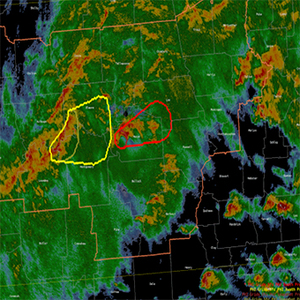
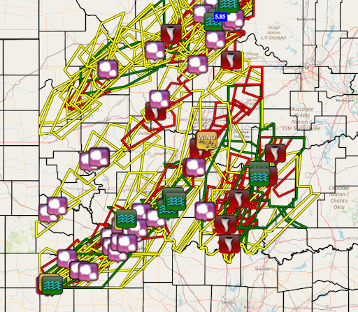
 A record 62 tornado warnings were issued by the NOAA NWS forecast office in Norman, Oklahoma during the April 27-28 tornado outbreak. With current software, the forecaster draws a warning polygon that is stationary and constrained to its original area; it can only be reduced in size, not expanded. If the storm abruptly changes direction or speeds up, a forecaster must issue a new warning to alert the public in the path. Ongoing research aims to streamline this warning process, reducing the workload for the forecaster and improving lead-times for communities downstream of the event.
In the 2024 NOAA Hazardous Weather Testbed, NOAA NWS forecasters are testing an experimental weather alert system called Threats In Motion (TIM) through the end of May. TIM lets forecasters create moving warning polygons for hazardous weather to alert the public in its path.
The legacy warning system poses a challenge for forecasters when the hazardous weather trend continues beyond the issued warning. Current procedures, policies, and software keep the forecaster from adjusting or moving the warning as the storm evolves. This results in inconsistent lead times, which can cause confusion due to overlapping warnings.
Since 2019, GSL has been working on “Taller TIM,” a system that lets forecasters issue and update warnings as often as needed. The software in the background nudges the warnings at a frequency as high as one-minute intervals between forecaster updates.

An intermediate step between the current warning workflow and Taller TIM is known as “Tiny” TIM. Tiny TIM modifies the current warning software so the forecaster can nudge the existing warning forward along the storm's trajectory. This results in less workload for the forecaster, greater comprehension of warning updates, and improved lead times for communities downstream of the hazard. Since Tiny TIM is similar to the current warning workflow, forecasters can adapt to the concepts easily. It is hoped that Tiny TIM will pave the way for the operational implementation of Taller TIM.
