2024 High Seas Polygon Workshop

 In June, NOAA GSL, GSL/Cooperative Institute for Research in the Atmosphere (CIRA) and NOAA Hurricane and Ocean Testbed (HOT) hosted a user-focused workshop to test Hazard Services software for high seas forecasts at the NOAA National Hurricane Center. This is part of a larger effort to modernize and streamline the process of issuing high seas forecasts and warnings, ultimately allowing the NWS to communicate a consistent and concise depiction of hazard risk for mariners.
In Hazard Services, users evaluated gridded wind, wave, and visibility forecasts, as well as analyses of synoptic features, creating a polygon “hazard” area in a format that can automatically be imported into navigational display systems. Similar gridded forecasts will be available for freezing spray forecasts.
Hazard Services is an ongoing project at GSL to streamline the process of issuing warnings for forecasters across a variety of phenomena. Currently, software for winter weather, severe weather, and hydrology have been rolled out to NWS operations.
Participants were from NHC’s Tropical Analysis and Forecast Branch, the Ocean Prediction Center, and the Honolulu Weather Forecast Office. Overall, the workshop was a success. Forecasters gained familiarity with the software, and potential challenges and bugs were discussed. Through the conversations with the forecasters and other researchers, GSL is developing plans for continuing their research-to-operations transition for Hazard Services.
With the feedback from the workshop, GSL hopes to have another evaluation of the Hazard Services high sea products in winter 2024-2025.
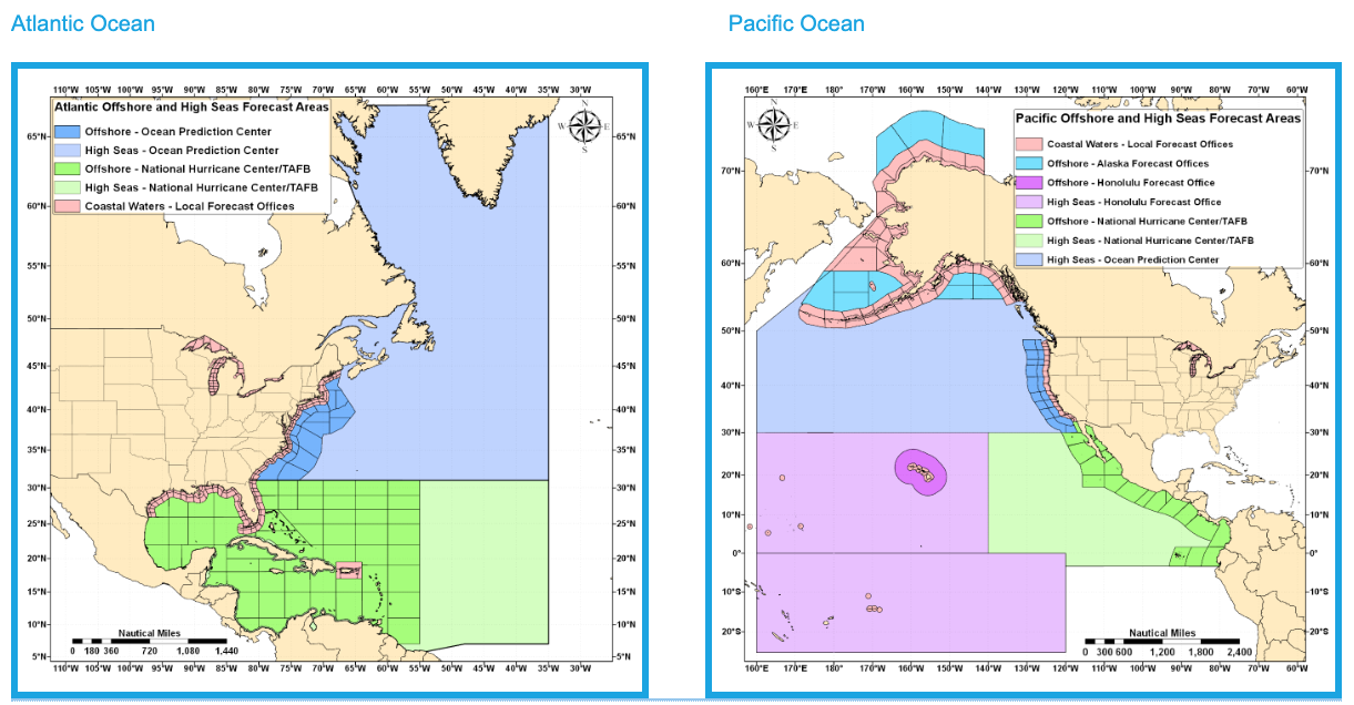
The NOAA National Weather Service (NWS) Marine Weather Services Program offers a broad range of marine forecast and warning products in graphical and text format. The NWS provides forecasts and warning services for the coastal waters along the mainland of the continental U.S., the Great Lakes, and the Offshore and High Seas waters of the North Atlantic and North Pacific Oceans.

