An official website of the United States government. Here's how you know.

Official websites use .gov
A .gov website belongs to an official government organization in the United States.

Secure .gov websites use HTTPS
A lock ( ) or https:// means you've safely connected to the .gov website. Share sensitive information only on official, secure websites.

WIDS

Weather Informatics and Decision Support Division

Who We Are

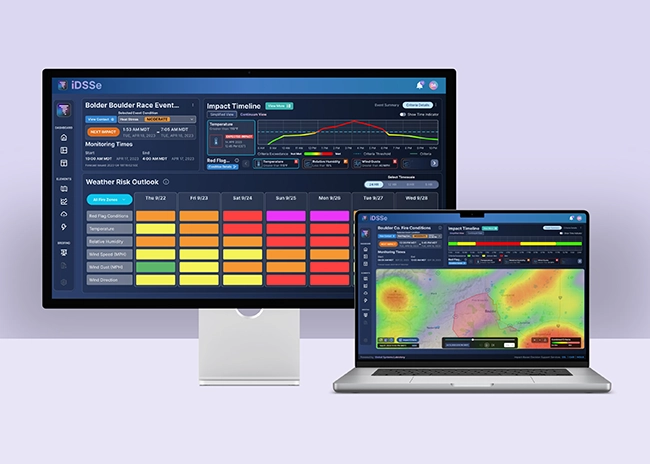
The Weather Informatics and Decision Support (WIDS) Division develops state-of-the-art environmental forecast, warning, decision support, and visualization tools. These capabilities support scientifically robust decision-making processes affected by the weather, water, and atmosphere. We do this by coupling the latest advancements in artificial intelligence, data visualization, social science research, and computer science/engineering with cutting edge atmospheric and environmental science to empower forecasters and decision makers with the best information they need.

WIDS aligns with the GSL Strategic Plan Goal 3: Revolutionize communications, products, and services to enable informed decision-making.

Areas of Research

  • Develop applications that improve analysis, visualization, verification, and decision support.
  • Research and develop techniques to improve understanding of and effectively communicate weather impacts to our core partners and society at large.
  • Ensure investments improve the skill, efficiency, and delivery of products, tools, and applications to operations.
  • Research using machine learning and artificial intelligence to enhance and improve the full weather prediction process from data ingest to modeling and decision support.

WIDS Branches

Fire Weather Testbed

The NOAA Fire Weather Testbed aims to accelerate the development and delivery of new tools, products, technologies, and communication strategies to users through an operations-to-research-to-operations process.

Social and Behavioral Sciences

To improve decision support, it is necessary to develop a deep understanding of how people access and use weather information, particularly our core partners.

Weather Information Systems Evolution

The Weather Information Systems Evolution (WISE) branch at NOAA's Global Systems Laboratory (GSL) focuses on developing advanced environmental forecasting, warning, decision support, and visualization tools.

Weather Visualization and AI Research Development

The Weather Visualization and AI Research Development (WIZARD) branch focuses on creating advanced environmental visualization and decision support tools, as well as integrating artificial intelligence into those tools and weather prediction models.

Highlights and Accomplishments

Advanced Weather Interactive Processing System (AWIPS)

GSL develops AWIPS, along with Raytheon, used by the National Weather Service (NWS), and other domestic and international organizations to process, visualize, and communicate earth-system data. AWIPS also provides the foundation for generating and disseminating forecasts and watch/warning/advisory information. WISE supports various enhancements to the AWIPS software, including cloud-based solutions and system administration.

Hazard Services (HS)

Hazard Services

Hazard Services display as captured by the NWS Omaha Forecast Office showing how they use Hazard Services to issue a tornado warning (outlined by a red line).

HS is a multi-year, multi-phase effort that modernizes the way watches, warnings, and advisories are created and communicated for hazardous earth system phenomena (e.g. storm surge, severe thunderstorms, volcanic ash). HS is a centralized application on the AWIPS platform, and utilizes ensemble-based, probabilistic, and machine learning techniques to inform the generation of hazardous conditions. This modernized methodology provides a more robust and precise depiction of hazard timing and spatial extent. The software also contains an extensible dissemination and formatting architecture, allowing for generation of modernized alerting formats, such as Common Alerting Protocol (CAP).

AWIPS Tsunami Operations Messaging Service (ATOMS)

AWIPS Tsunami Operations Messaging Service

ATOMS is a modernization of the NWS National Tsunami Warning System. ATOMS provides consistent Integrated Decision Support Services (IDSS), product generation and formatting, and dissemination capabilities for the NWS Tsunami Warning Centers (TWCs). ATOMS also provides a foundation for centralized system management between the TWCs, and integrates with HS to allow for consistent and diverse product alerting. The AWIPS Tsunami Operations Messaging Service under development by GSL

The Integrated Decision Support Services (IDSS) Engine

The Impact-based Decision Support System (IDSS) Engine, developed by GSL, provides tailored weather information to support critical decision-making processes. The IDSS Engine integrates real-time data, advanced modeling, and user-specific criteria to help meteorologists in the NWS provide clear, timely, and precise guidance to key stakeholders, such as emergency managers and other government partners. The IDSS Engine enhances the ability to respond effectively to weather-related threats, improving public safety and operational efficiency during high-impact events.

Integrated Decision Support Services Engine

Dynamic Ensemble-based Scenarios for Impact-based Decision Support (DESI)

Dynamic Ensemble-based Scenarios for Impact-based Decision Support

A DESI display showing the mean time of arrival of winds greater than 40mph from Hurricane Helene impacting the Florida coast.

DESI is a powerful decision support web and cloud-based application that provides forecasters, decision-makers, and other stakeholders with ensemble-based weather forecast information and visualizations. NWS meteorologists can use DESI to make graphics for their partners and the public that communicate when and where impacts are expected to occur, and the confidence in those estimates.

WAVE

 Weather Archive and Visualization Environment (WAVE)

The Weather Archive and Visualization Environment (WAVE) is a web-based graphical interface to produce weather graphics for the public.

Threats-in-Motion

Threats-in-Motion

An animated GIF showing threats in motion over Alabama. The moving yellow line is a severe thunderstorm warning. The red moving line is a tornado warning traveling eastward with the lines of thunderstorms.

TIM is a warning generation approach that enables the NWS, and international meteorological agencies, to advance severe thunderstorm and tornado warnings from the current static polygon system to continuously updating polygons that move forward with a storm. With TIM, a warning polygon is attached to the threat and moves forward along with it. This provides more uniform, or equitable, lead time for all locations downstream of a storm. his provides more uniform, or equitable, lead time for all locations downstream of a storm, and allows for the possibility of issuing all clear messages once the threat has passed.

Messaging Under the Microscope: Evaluating Official Risk Communication During the Marshall Fire

Evaluating the Fire Weather Product Suite: Insights from the Field and the Publics

Wildfires pose a growing threat across the U.S., making the effective communication of fire weather conditions more vital than ever. Researchers at the Global Systems Laboratory are leading a multi-phase research project investigating how fire management professionals and the public interpret and react to National Weather Service (NWS) Fire Weather Watches (FWWs) and Red Flag Warnings (RFWs). Through focus groups, surveys, and collaborative work with local Weather Forecast Offices (WFOs), the project seeks to bridge the gap between forecasting and decision-making to ultimately improve wildfire preparedness and response.

In focus groups with 85 fire managers across the country, GSL researchers learned that RFWs aren't always the main trigger for action, but do play a pivotal role. They help justify decisions, boost awareness among newer staff, and support communication with the public. These findings will lead to practical recommendations to fine-tune warnings.

Building upon this, GSL will be expanding reach through a national survey of fire professionals, digging deeper into the tools most frequently used, how probabilistic forecasts are interpreted, and what information is essential to make safer, faster decisions in the field. Additionally, GSL is planning on reaching out to communities affected by wildfire risk and hearing their perspectives, including emphasis on how people interpret fire weather alerts and their understanding of RFWs. These answers will help ensure warnings are clear and useful.

At every step, GSL researchers are partnering with local WFOs to turn findings into action. By keeping a tight loop between researchers, forecasters, and partners, this research will inform strategies for fire weather alerts that work better for professionals and the public alike.

Our Mission

Lead research and directed development through the transition of environmental data, models, products, tools, and services to support commerce, protect life and property, and promote a scientifically literate public.

Research Areas

Organizational Excellence, Earth System Prediction, Advanced Technologies, and Decision Support are the foundation to achieving the GSL Grand Challenge: Deliver actionable global storm-scale prediction and environmental information through advanced technologies to serve society.

Global Systems Laboratory